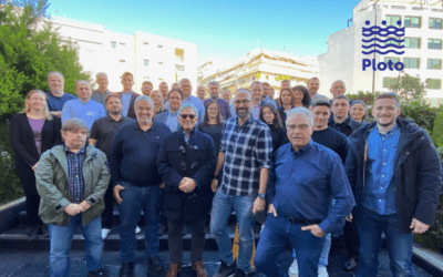
The PLOTO project kicked off in September 2022 with an event hosted by the coordinating organisation Netcompany-Intrasoft, which gathered all 20 consortium partners in Athens, Greece. The project, whose full name is Deployment and Assessment of Predictive modelling, environmentally sustainable and emerging digital technologies and tools for improving the resilience of IWW (Inland WaterWays) against climate change and other extremes, will support for 42 months Horizon Europe’s vision for 2021-2027 that aims at tackling climate change and turning Europe into a climate-resilient society by 2050. The project will accelerate the freight transport and logistics sectors’ shift to greater automation, digitalisation, standardisation, and interoperability of processes, technology, and logistics.
The ambitious goals of PLOTO entail utilising both established tools and services, such as climate models, modelling of extreme events and their impacts, early warning systems (EWS), environmental monitoring sensors, and EU services, such as Copernicus), as well as new developments (such as Nature-Based Solutions – NBS, as well as ICT, such as water, terrestrial and satellite imaging, Machine Learning (ML), enhanced data fusion techniques, etc. These objectives go hand-in-hand with the primary goal of the project to address multi-hazard environmental risks, offering a smart, fast and efficient response while supporting operational, strategic adaptation and mitigation measures.
Considering the specific outcomes expected from the demonstrations and work package activities, PLOTO can be defined as a purely technological project. This means that at the core of the initiative, there are a series of technological pillars identifying the technical framework for the innovation process of the project. The technological backbone of PLOTO is represented by:
- Climate, Atmospheric Forcing, and Multi-Hazard Modelling: Introduction of a research framework for estimating environmental risk down to the IWW scale and providing high-resolution maps of environmental pressures, whereupon fragility/vulnerability functions for IWW sites will be determined.
- Multi-Hazard Vulnerability Modules and Assessment Toolkit (MHVAT) for IWW and assets: The development of the Toolkit software will suit to offer an integrated analytical assessment of the vulnerability of IWW under natural or/and man-made hazards, as well as mixed hazards.
- Improved Computer Vision (CV) Techniques and ML Techniques: PLOTO aims to use existing monitoring tools, which will be supported by novel Computer Vision (CV) techniques and ML algorithms.
- Remote Sensing, including Quick Assessment Damage Maps: The system developed in the project would provide local details in case of a significant disaster event, thus completing the damage maps generated through Copernicus Emergency Management Service (EMS).
- Fore-Now/Casting Weather Predictions Methods & Tools: Implementation of Early Warning Systems (EWS) to anticipate extreme weather events and their impact on the IWW and connected networks.
- PLOTO Middleware and Data Fusion (DF): Implementation of a novel middleware that will incorporate current information systems and available sensor networks. DF Languages (DFL) will be used to provide functionalities that is currently provided by a number of engines.
- IWW Assessment Tool (IWAT) and IWW Digital Twin (DT): The tool will undertake the integration and chaining of the hazard analysis and simulation tools, providing the simulation to run impact/resilience assessment scenarios for the test cases. The IWW DT will build a data representation of assets, processes and systems in the IWW-built and natural environment.
- Enhanced visualisation Common Operational Picture (COP), Incident Management System (IMS) and Decision Support System (DSS): All COP functionalities will be integrated to provide enhanced situational awareness capabilities to the IWW operators. The IMS will implement protocols for multi-agency interaction and communication to integrate and synchronise actions of participating organisations and jurisdictions to ensure unity of effort. The DSS aims to support human reasoning, assisting IWW operators in the decision-making process.
On one hand, the three project pilot sites in Belgium, Hungary and Romania will be the testbeds to demonstrate the suitability of the PLOTO platform for multiple hazard assessment and optimised operational and strategic decisions for management and maintenance of IWW, considering as well other hazards relevant for other sections of the same corridor, or for other critical parts of IWWs. The Danube area in Romania, the Budapest inland port in Hungary and the Belgian region of Wallonia have been selected because of the specificities of the territory and the different impacts of extreme environmental conditions in the selected portion of IWW.
On the other hand, the consortium members involved in the technological work packages will perform preliminary module and system assessment and validation campaigns before the demonstrations in the three pilot sites (Belgium, Hungary, Romania). Then, the second cycle will be characterised by the definition of the integrated PLOTO system, which will be based on the technical and operational assessments to be carried out in the first round of demonstration activities. This iterative approach also includes a series of intermediate validations, where end users will be introduced to the developed and evolved solutions, allowing for timely and resource-efficient incorporation of their feedback and the greatest possible alignment of their needs with the project outcomes. In order to finally implement and demonstrate the technical, social, and, institutional measures elaborated within the work packages, they will first be replicated by the PLOTO Digital Twin system, before their evaluation against various economic and other types of metrics.
Overall, the resulting outcomes of the PLOTO project will further consolidate the high quality of productivity and efficiency of the freight and logistics sectors in Europe, while ensuring a reliable network availability under unfavourable conditions, such as extreme weather, earthquakes, and, other kinds of hazards.